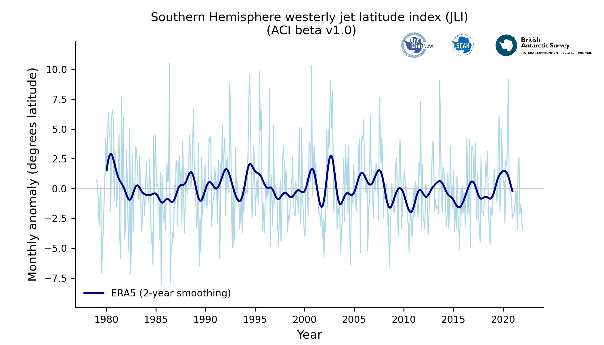

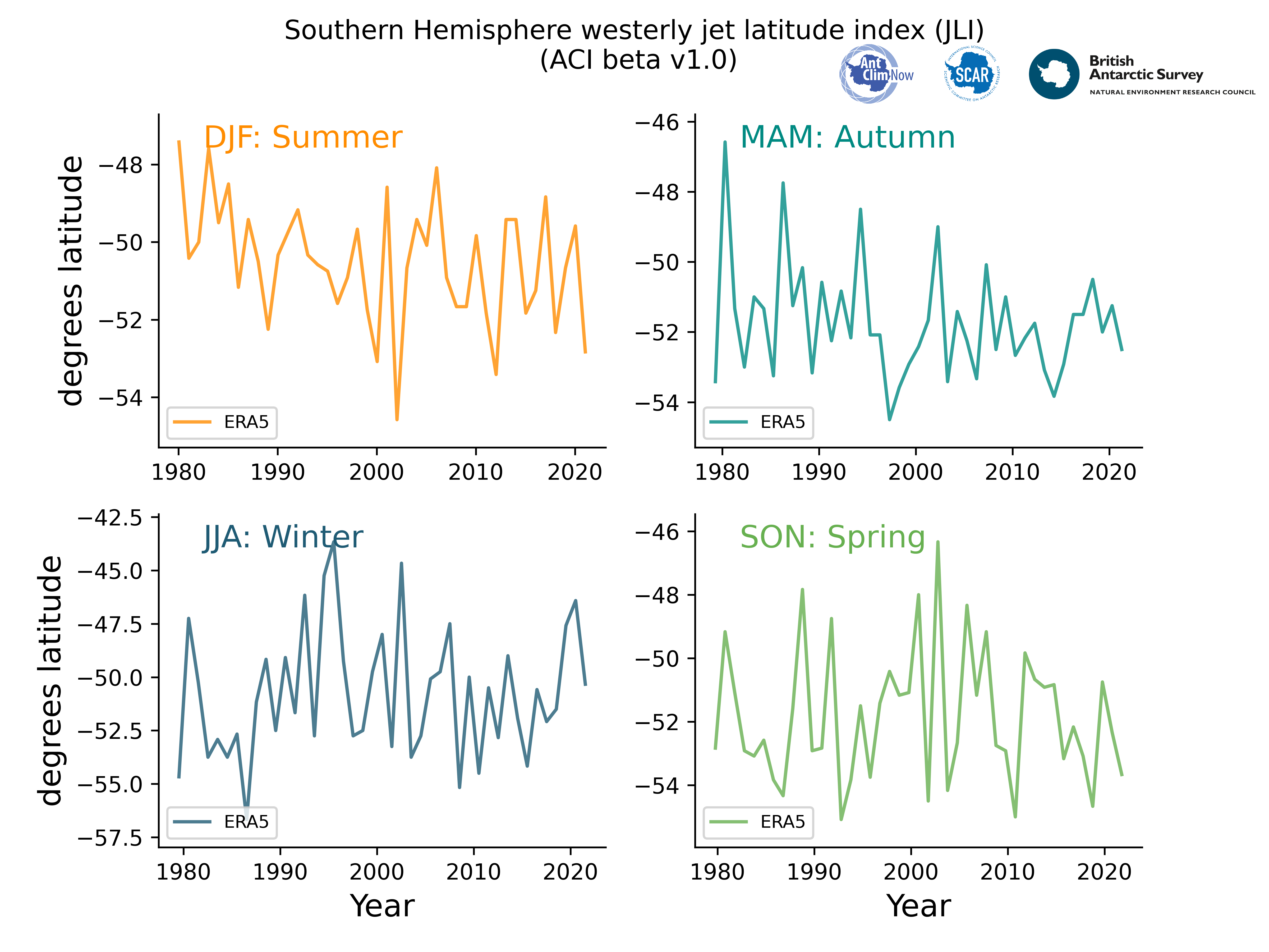
Jet Latitude Index (JLI)
Why is JLI important?
Jet latitude index is a measure of the latitudinal position of core of the westerly winds blowing over the Southern Ocean
The westerly winds are strongly coupled to the Antarctic Circumpolar Current and sea ice (Bracegirdle at al., 2020). Greater sea ice drives a poleward shift in the jet, especially in winter (Smith et al., 2017). These shifting winds bring warmer waters from the Southern Ocean, the incursion of which onto the continental shelf amplifies melting at the base of coastal ice sheets, contributing to their instability and collapse. However, the poleward trend of these tropospheric winds during the summer months is due to ozone depletion in the stratosphere above (Polvani et al., 2011).
Such imbalances in these westerlies lead to even greater rates of heat and CO2 uptake by the Southern Ocean (which is the largest CO2 sink globally).
Description of the data
This dataset documents the trends and variability in the latitude and speed of the belt of lower-atmosphere westerly winds over the Southern Ocean, referred to as the ‘westerly jet’. Time series of annual mean and seasonal diagnostics are available for the period 1959-present, specifically time series of seasonal and annual mean jet latitude and speed. The diagnostics are derived from the European Centre for Medium Range Weather Forecasts (ECMWF) ERA5 reanalysis (Hersbach et al., 2020), which is an observationally-constrained reconstruction of atmospheric conditions. The broad characterisation of the westerly winds into these simple diagnostics has been found to be useful for understanding long-term climate change due to contrasting drivers of change and impacts on other aspects of the climate system.
The jet indices shown here were calculated following the definition detailed in Bracegirdle et al. (2018). This is based on westerly wind in the lower atmosphere (850 hPa, which is approximately 1.5 km above mean sea level). At each latitude, the all-longitude (zonal) average was calculated between 75 °S and 10 °S. The maximum in this diagnostic is defined as the jet speed (jet speed index – JSI) and its location defines the jet latitude (jet latitude index – JLI) . This is a very similar approach to that used in a number of other studies, e.g. (Kidston & Gerber, 2010; Son et al., 2010; Swart & Fyfe, 2012).
Acknowledgements
The European Centre for Medium Range Weather Forecasting is thanked for providing the ERA-Interim datasets.