News and Research Updates from the Southern Ocean Bathymetry Community.
International Bathymetric Chart of the Southern Ocean (IBCSO) Expert Group
News and Research Updates from the Southern Ocean Bathymetry Community.
Publications, Data and Links of interest to the Southern Ocean Bathymetry Community
Poster presentation at the EGU Spring Meeting 2020: Hehemann, L., Arndt, J. E., and Dorschel, B.: IBCSO V2.0: An updated Antarctic bathymetry product of Seabed 2030, EGU General Assembly 2020, Online, 4–8 May 2020, EGU2020-3529, https://doi.org/10.5194/egusphere-egu2020-3529, 2020
pdf Poster presentation at XXII ISAES (1.14 MB) , 16. July 2015. Open Poster.
pdf Oral presentation at the Eighth Annual GEBCO Bathymetric Science Day (4.78 MB) in Venice, 8. October 2013.
IBCSO V1.0 Release Paper: "The International Bathymetric Chart of the Southern Ocean (IBCSO) Version 1.0 - A new bathymetric compilation covering circum-Antarctic waters", Geophysical Research Letters, doi: 10.1002/grl.50413, Arndt et al. 2013
document Oral presentation at the "25. Internationale Polartagung der DGP" in Hamburg (3.55 MB) , 20. March 2013.
pdf Poster presentation at the AGU Fall Meeting (3.42 MB) in San Francisco, 7. December 2012.
pdf Oral presentation at the XXXII SCAR and Open Science Conference in Portland (3.54 MB) , 16. July 2012 entitled 'IBCSO v1 - A preview of the International Bathymetric Chart of the Southern Ocean'.
pdf Poster presentation at the AGU Fall Meeting (5.42 MB) in San Francisco, 5. December 2011.
Oral presentation at the Intergeo 2008 HTML logo.png, Bremen, Germany, October 2008.
Oral presentation by Ott and Schenke entitled 'Polar Ocean Mapping: Significance of Bathymetry for Observing Systems' at the SCAR/IASC Open Science Conference, St Petersburg, Russia, 8-11 July 2008.
Poster presentation at the SCAR/IASC Open Science Conference, St Petersburg, Russia, 8-11 July 2008.
Joint IBCAO and IBCSO poster presentation at the SCAR/IASC Open Science Conference, St Petersburg, Russia, 8-11 July 2008.
Hydro International Feature Article entitled 'Southern Ocean Bathymetry', November 2007
Oral presentation by Ott and Schenke entitled 'GIS based Data Compilation of the new IBCSO' at the 10th ISAES HTML logo.png , University of California, Santa Barbara, USA, August 2007
Extended Abstract of a poster presentation by Macnab et al., at the International Symposium Asian Collaboration in IPY 2007-2008, Tokyo, Japan, 1 March 2007.
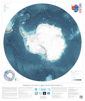
The digital bathymetric model (DBM) of IBCSO Version 2.0 has a 500m x 500m resolution based on a polar stereographic projection (EPSG: 9354) for the area south of 50° S. It is publicly available together with a digital chart for printing.
The projection used for IBCSO v2 was registered in April 2020 under EPSG: 9354.
A .prj file containing the projection string can be downloaded from the PANGAEA website.
If you are using any data from IBCSO v2, please use the following citation:
Dorschel, Boris; Hehemann, Laura; Viquerat, Sacha; Warnke, Fynn; Dreutter, Simon; Schulze Tenberge, Yvonne; Accetella, Daniela; An, Lu; Barrios, Felipe; Bazhenova, Evgenia A; Black, Jenny; Bohoyo, Fernando; Davey, Craig; de Santis, Laura; Escutia Dotti, Carlota; Fremand, Alice C; Fretwell, Peter T; Gales, Jenny A; Gao, Jinyao; Gasperini, Luca; Greenbaum, Jamin S; Henderson Jencks, Jennifer; Hogan, Kelly A; Hong, Jong Kuk; Jakobsson, Martin; Jensen, Laura; Kool, Johnathan; Larin, Sergey; Larter, Robert D; Leitchenkov, German L; Loubrieu, Benoit; Mackay, Kevin; Mayer, Larry; Millan, Romain; Morlighem, Mathieu; Navidad, Francisco; Nitsche, Frank-Oliver; Nogi, Yoshifumi; Pertuisot, Cécile; Post, Alexandra L; Pritchard, Hamish D; Purser, Autun; Rebesco, Michele; Rignot, Eric; Roberts, Jason L; Rovere, Marzia; Ryzhov, Ivan; Sauli, Chiara; Schmitt, Thierry; Silvano, Alessandro; Smith, Jodie E; Snaith, Helen; Tate, Alex; Tinto, Kirsty; Vandenbossche, Philippe; Weatherall, Pauline; Wintersteller, Paul; Yang, Chunguo; Zhang, Tao; Arndt, Jan Erik (2022): The International Bathymetric Chart of the Southern Ocean Version 2 (IBCSO v2). PANGAEA, doi: 10.1594/PANGAEA.937574
The accompanying publication was published in Nature Scientific data:
Dorschel B, Hehemann L, Viquerat S, Warnke F, Dreutter S, Schulze Tenberge Y, Accetella D, An L, Barrios F, Bazhenova EA, Black J, Bohoyo F, Davey C, de Santis L, Escutia Dotti, Carlota Fremand AC, Fretwell PT, Gales JA, Gao J, Gasperini L, Greenbaum JS, Henderson Jencks J, Hogan KA, Hong JK, Jakobsson M, Jensen L, Kool J, Larin S, Larter RD, Leitchenkov GL, Loubrieu B, Mackay K, Mayer L, Millan R, Morlighem M, Navidad F, Nitsche FO, Purser A, Rebesco M, Rignot E, Roberts JL, Rovere M, Ryzhov I, Sauli C, Schmitt T, Silvano A, Smith JE, Snaith H, Tate AJ, Tinto K, Vandenbossche P, Weatherall P, Winterstellar P, Yang C, Zhang T, Arndt JE (2022): International Bathymetric Chart of the Southern Ocean Version 2 (IBCSO v2). doi: 10.1038/s41597-022-01366-7
The IBCSO database currently consists of more than 25 billion data points contributed by 88 institutions from 22 countries. In total, 498 multibeam and 950 singlebeam echo sounding data were building the core data of our database. Digitized soundings from nautical charts, LIDAR, gravity data and regional bathymetric compilations are rounding off the database. A list of datasets used for the compilation of IBCSO v2 can be downloaded here:
Coverage
An overview of included data sources and the spatial distribution can be seen in the source identification map (above right).
The IBCSO group aims to identify data gaps and areas that suffer from low data quality, such as outdated singlebeam data. The IBCSO TID grid can be used to identify areas with high quality multibeam. For an easier access to this information, we also provide a GIS-ready geopackage showing the outline of multibeam and singlebeam surveys contained in IBCSO v2 here:
If you are holding bathymetric data that is not yet included in the IBCSO database, we encourage you to contribute your data to improve the IBCSO digital bathymetric model for the benefit of all. Contributed data will be acknowledged and will only be used to generate the IBCSO digital bathymetric model. To contribute data, please This email address is being protected from spambots. You need JavaScript enabled to view it..
To enable users to visualize their own data on a map with the IBCSO look and feel, we are offering the base data of the IBCSO printable chart as a georeferenced image. The 'Background' maps contain RGB rasterfiles in GeoTiff format, which is compatible with most GIS programs.
For further information on the IBCSO group, please email southern-ocean[at]seabed2030.org.
Our center team is involved with, not only the production of IBCSO, but also in developing best methods for infrastructure and innovation, establishing a sense of community and facilitating collaboration, and in acquiring bathymetric datasets in uncharted waters.
![]() |
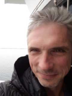
Boris Dorschel is the project lead as head of the bathymetry working group in the geophysics department at AWI. Since 2012, he credits his time to the geo-morphology of the seafloor in high latitudes with special emphasis on the reconstruction of ice sheet histories and habitat mapping. As part of his activities, he collects multibeam echosounder data from around Antarctica and the Arctic. With his expertise and passion for running highly-collaborative projects at a global level, he is keen to lead bathymetric mapping expeditions and expand the impact for the IBCSO. |
![]() |
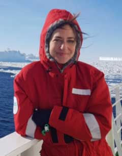
Laura Hehemann is the data manager and curator for the project responsible for building a robust and sustainable hub. She collaborates with key bathymetry stakeholders in the shared Seabed 2030 vision to map the world’s oceans. She joined AWI in 2016 as a geographic information systems (GIS) analyst engaging scientists in web-based services and providing GIS expertise. After various research expeditions to the Arctic, working with optical and acoustical data from the Ocean Floor Observation and Bathymetry System (OFOBS) and the ships multibeam echosounder, she made her first voyage to the Antarctic in 2019. |
![]() |
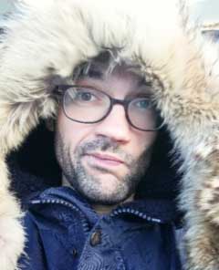
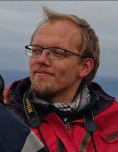
Sacha Viquerat is our chief data engineer for the project. With a background in biological sciences, mainly marine mammals, and scientific programming and statistics, he joined the team primarily to re-implement the data processing pipeline and scale the existing workflow onto AWI's high-performance infrastructure. He made his first trip to Antarctica in 2014 and has since participated and contributed in various national and international projects. His work in Seabed 2030 involves heavy usage of the Python programming language for parallel computation and geographic libraries in a UNIX environment and coined our SEAHORSE workflow. |
![]() |
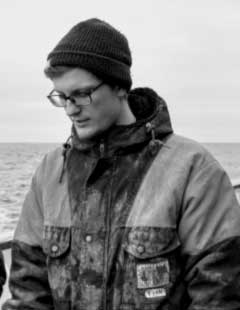
Simon Dreutter is the data manager of the bathymetry working group at AWI, providing data and insight into the bathymetry archive. He has several years of ocean-going experience and a main research interest in high-resolution multisensor habitat mapping in deep sea environments. He oversaw the technical integration of the acoustical systems into the OFOBS platform and regularly trains students for bathymetry acquisition. As a skilled cartographer, passionate programmer and inspiring educator, he brings a diverse perspective and high quality to the project. |
![]() |
Fynn Warnke has participated in several research cruises worldwide (Antarctica, Baffin Sea, southern Indian Ocean) and two industry cruises (North Sea, Baltic Sea). He joined the team as a talented and passionate data engineer bringing expertise in bathymetric mapping and innovation to working with big data. He is highly trained in scientific computing, namely Python, Matlab, and motivated to implement new techniques and approaches to advance the project. |
![]() |
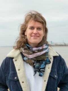
Yvonne Schulze Tenberge supports the IBCSO team with her knowledge of PostgreSQL databases and programming skills. She has a background in environmental engineering and fluvial geomorphology. Since 2020, she works as a data engineer for the AWI Bathymetry group in the project mareHub with focus on data visualization. |
![]() |
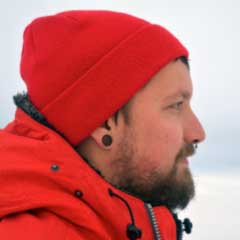
Patrick Schwarzbach, semi-professional photographer, web designer and private teacher, supports Seabed 2030 by increasing outreach on various platforms for the Southern Ocean Regional Center. Furthermore, he helps to enhance data analysis as a multidisciplinary trained scientist. He first came in touch with marine sciences working from 2018 to 2020 at the German Oceanographic Museum in Stralsund and looks forward to his first Antarctic expedition. |
![]() |
Jan Erik Arndt was the co-chair of the IBCSO project from 2010 until 2021, and the co-lead until 2021. In 2013, he completed the first version of IBCSO, which has gained tremendous popularity since. He established the initial workflows and the network, laying the foundation of IBCSO as we have it today. |
The Southern Ocean Regional Mapping Committee (SO-RMC) is overseen by an Editorial Board and was updated during the First Arctic, Antarctic and North Pacific Mapping Meeting held in Stockholm, October 8-10, 2018 to currently include the following members:
Felipe Barrios | Servicio Hidrografico y Oceanografico de la Armada (SHOA) | Chile |
Jenny Black | Institute of Geological and Nuclear Sciences (GNS) | New Zealand |
Fernando Bohoyo | Instituto Geologico y Minero de Espana (IGME) | Spain |
Harald Brekke | Norwegian Petroleum Directorate (NPD) | Norway |
Miquel Canals | University of Barcelona (UB) | Spain |
Jongkuk Hong | Korean Polar Research Institute (KOPRI) | Korea |
Martin Jakobsson | University of Stockholm (SU) | Sweden |
Johnathan Kool | Australian Antarctic Division (AAD) | Australia |
Robert D. Larter | British Antarctic Survey (BAS) | UK |
German Leitchenkov | The All-Russia Scientific Research Institute for Geology and Mineral Resources of the Ocean (VNIIOkeangeologia) | Russia |
Hugo Montoro | Direccion de Hidrografía y Navegacion de la Marina de Guerra del Peru (DHN) | Peru |
Frank O. Nitsche | Lamont-Doherty Earth Observatory (LDEO) | USA |
Yoshifumi Nogi | National Institute of Polar Research (NIPR) | Japan |
Michele Rebesco | Istituto Nazionale di Oceanografia e di Geofisica Sperimentale (INOGS) | Italy |
Walter Reynoso-Peralta | Servicia Hydrographica Naval (SHN) | Argentina |
Jodie Smith | Geoscience Australia (GA) | Australia |
If you have substantial interest in the Southern Ocean bathymetry please subscribe to the IBCSO mailing list at the National Geophysical Data Center in Boulder, Colorado.
Poster presentation at the EGU Spring Meeting 2020: Hehemann, L., Arndt, J. E., and Dorschel, B.: IBCSO V2.0: An updated Antarctic bathymetry product of Seabed 2030, EGU General Assembly 2020, Online, 4–8 May 2020, EGU2020-3529, https://doi.org/10.5194/egusphere-egu2020-3529, 2020
pdf Poster presentation at XXII ISAES (1.14 MB) , 16. July 2015. Open Poster.
pdf Oral presentation at the Eighth Annual GEBCO Bathymetric Science Day (4.78 MB) in Venice, 8. October 2013.
IBCSO V1.0 Release Paper: "The International Bathymetric Chart of the Southern Ocean (IBCSO) Version 1.0 - A new bathymetric compilation covering circum-Antarctic waters", Geophysical Research Letters, doi: 10.1002/grl.50413, Arndt et al. 2013
document Oral presentation at the "25. Internationale Polartagung der DGP" in Hamburg (3.55 MB) , 20. March 2013.
pdf Poster presentation at the AGU Fall Meeting (3.42 MB) in San Francisco, 7. December 2012.
pdf Oral presentation at the XXXII SCAR and Open Science Conference in Portland (3.54 MB) , 16. July 2012 entitled 'IBCSO v1 - A preview of the International Bathymetric Chart of the Southern Ocean'.
pdf Poster presentation at the AGU Fall Meeting (5.42 MB) in San Francisco, 5. December 2011.
Oral presentation at the Intergeo 2008 HTML logo.png, Bremen, Germany, October 2008.
Oral presentation by Ott and Schenke entitled 'Polar Ocean Mapping: Significance of Bathymetry for Observing Systems' at the SCAR/IASC Open Science Conference, St Petersburg, Russia, 8-11 July 2008.
Poster presentation at the SCAR/IASC Open Science Conference, St Petersburg, Russia, 8-11 July 2008.
Joint IBCAO and IBCSO poster presentation at the SCAR/IASC Open Science Conference, St Petersburg, Russia, 8-11 July 2008.
Hydro International Feature Article entitled 'Southern Ocean Bathymetry', November 2007
Oral presentation by Ott and Schenke entitled 'GIS based Data Compilation of the new IBCSO' at the 10th ISAES HTML logo.png , University of California, Santa Barbara, USA, August 2007
Extended Abstract of a poster presentation by Macnab et al., at the International Symposium Asian Collaboration in IPY 2007-2008, Tokyo, Japan, 1 March 2007.
© The Scientific Committee on Antarctic Research (SCAR) 2020 | A committee of International Science Council
SCAR is registered as a Company and a Charity in the UK: Company Number 6564642; Charity Number 1124840
Website Disclaimer and Cookie Policy
Joomla Migration and Design by Migrate My Joomla.